
T
QGIS for Mineral Exploration
Overview
If you’re interested in attending this course when it is next offered please register your interest here.
Delivery
Online & Interactive
Structure
4 x stand alone modules
Each module is 4.5 hours, inclusive of breaks
Course Leader Grant Boxer, FAIG, MGSA
Dates
Module 1
Tuesday 10 March
Introduction to QGIS
Module 2
Wednesday 11 March
Importing, Managing & Displaying Data
Module 3
Tuesday 17 March
Working with Drillhole, Geochemical & Geophysical Data
Module 4
Wednesday 18 March
Working with Satellite Data
Daily Session Times
9:00 to 13:30 AWST (Perth)
11:00 to 15:30 AEST (Townsville, Brisbane)
12:00 to 16:30 AEDT (Sydney, Melbourne)
Professional Development 4 hours per module
Participation in this course may contribute to the Continued Professional Development (CPD) requirements of professional institutes.
Registration Fees
Fees per module
AUD inclusive of GST
EGRU Member AUD 300
Non Member AUD 420
AIG Member AUD 350
Student (full-time) AUD 130
Please send course enquiries to EGRU_training@jcu.edu.au.
Content
Module 1
Introduction to QGIS
Tuesday 10 March 2026
Prerequisite: Basic knowledge of GIS
- What is QGIS?
- QGIS interface and menus
- Menu bars, tool bars and panels
- Selecting features and the attribute panel
- Basic map making, use of templates and map legends, adding WMS
- Creating a map and designing a print layout
- Add map features, grid, scale bar, legend, north arrow
- Duplicate layout and add geological map
- Importing and display of field data (points, lines and polygons)
- Adding field data from csv
- CSV markers, layer properties
- Creating forms and displaying photos
Module 2
Importing, Managing & Displaying Data
Wednesday 11 March 2026
Prerequisites: Completion of Module 1 or previous knowledge of QGIS
- On-Line Sources for GIS data
- gov.au, Landgate, DMIRS, Geoscience Australia
- QuickMapServices plug-in
- Basic editing skills, selecting data
- Create points, lines and polygons
- Importing GPX files
- Importing SVG and style files, using the QGIS style manager
- SVG geological pattern fills
- Labelling
- Spatial and non-spatial joins
- Georeferencing images
Module 3
Working with Drillhole, Geochemical & Geophysical Data
Tuesday 17 March 2026
Prerequisites: Completion of Module 1 or previous knowledge of QGIS
- Drill hole display using the Geoscience plugin
- Geochemical data import, gridding, contouring and display
- Geophysical data import, basic gridding and display
- 3D Visualisation using the QGIS2Threejs plugin
- Spatial and non-spatial joins
- Georeferencing images
Module 4
Working with Satellite Data
Wednesday 18 March 2026
Prerequisites: Completion of Module 1 or previous knowledge of QGIS
- Satellite data, data sources, NASA and ESA data portals
- Download, display and basic processing of ASTER and Sentinel 2 data
- Band combinations for enhancing geology and regolith in satellite imagery
Course Leader: Grant Boxer
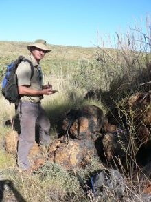 Grant is a consultant geologist based in Perth, Western Australia, with over 40 years’ experience in exploration and mining geology. For almost two decades he was employed by CRA Exploration, Argyle Diamonds and Rio Tinto Exploration on exploration and evaluation activities for diamonds and other commodities. Since 1998, Grant has been undertaking project generation, primarily for diamonds in Australia and overseas, carrying out GIS data compilations, project reviews, field visits, project management, and drilling and sampling program supervision.
Grant has a keen interest in GIS and remote sensing and has been a user of GIS since the mid-1990’s. He has been running QGIS courses tailored for geoscientists around Australia for many years, usually in association with the Australian Institute of Geoscientists. Grant also has a keen interest in meteorite impact structures.
Grant is a RPGeo and Fellow of the Australian Institute of Geoscientists, member of Geological Society of Australia, the Geological Remote Sensing Group, and the Meteoritical Association.

